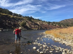
Point Barr is unclaimable land on the Arkansas River where you can drive right to the riverside and get to digging!
The gold here is the typical fine Arkansas River material. This means fairly consistent in size – small! This means it would be the ideal place to run a Gold Cube; read about that prospecting tool here:
https://findinggoldincolorado.com/using-a-gold-cube-in-colorado/
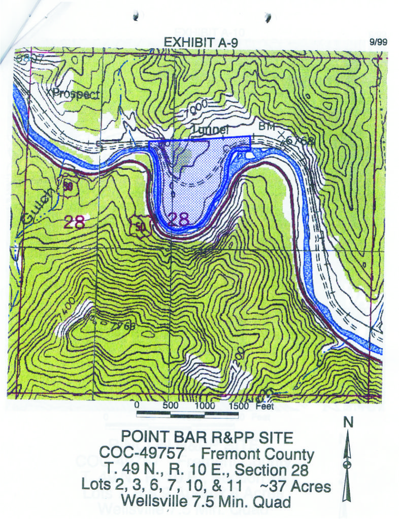
As you can guess from the map of the 37-acre site above (almost as big as two mining claims!), there’s plenty of river to work here and plenty of dry camping space too. The BLM allows dry camping which means you have to bring everything you need and pack it all out too. There is a fee to spend the night ($28 as of the time of writing in June 2020).
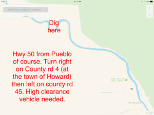
The tricky part is access. Coming west on Highway 50 from Pueblo, the turnoff to Point Barr takes you to a road that runs along the water at times. When the water is high this road can be closed or sketchy…even when the water isn’t high, 4WD is always recommended and high clearance is always required. If you don’t know what “high clearance” means, you have the wrong vehicle and should approach from the upstream side instead. Expect high water in June, July, and the first half of August due to runoff as the high mountain snows melt and water levels are kept artificially high to support the rafting industry.
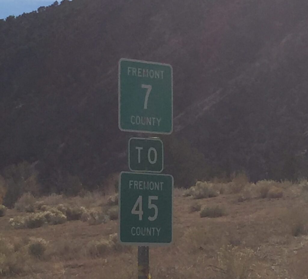
Driving east from Salida is easier with a decent road the whole way. From Highway 50, here’s the sign to look for near Wellsville:
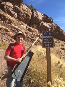
Anyway, as you can see the borders of the public mining area are well marked. There are private claims just upstream and downstream so please do look for the signs 🙂
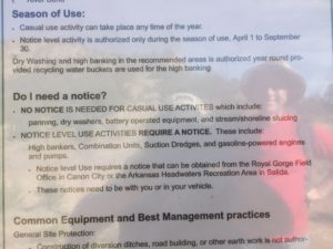 There’s a sign with rules on site. I’ve also included the link below to my prior article which will get you to the BLM info pages on this site (as well as many other places you are welcome to dig!).
Note: you will variously see this site called “Point Bar” and Point Barr”. I have chosen the latter name since it is more unique…there are lots of point bars in lots of rivers but only this Point Barr.
Related post: another public location fairly nearby: https://findinggoldincolorado.com/cache-creek-prospecting-site/
And there is a whole list of public dig sites with driving instructions and so on in my article here. If that isn’t enough for you, I recommend my gold prospecting guide book with over 180 public access gold prospecting sites!!
This site costs money to keep up. The only way it makes money is shopping referrals. If you appreciate the info here, please click thru one of my Amazon ads the next time you want to shop online. It won’t cost you anything extra and it keeps the site going!


10 thoughts on “Point Barr Prospecting Site on the Arkansas River”
Here’s a detailed description of how to approach from the east:
You can still get in via Fremont 4 in Howard, then Fremont 45 into Point bar. One should be able to get a full size Pick up in. 4×4 recommended, Doable in a 4×2 if a fair bit of ground clearance.
Once you get on Fremont 45, You will start seeing signs (4×4 only, high clearance recommended, Water crossing, and not a through road)
Take CR 45, You will come to a place where the road will drop sharply. This has lots of rocks and boulders and in my opinion the most challenging part of the road. I traveled this road the week after fourth of July in my Subaru outback with no problems.A few years prior in a Pontiac Gran prix.
At the bottom you will come to Badger creek, hang a left, drive through the stream for about 100 feet, turn right to resume on the road. This is a steep climb but not as rocky as the previous portion. Once on this it is fairly easy going. The road will go right next to the river, and a portion of it the river is covering the road. This is reinforced by river rock and is very stable. At this point, and forward there is no room for vehicles to pass or pull to side to let someone pass, so you must look as far as you can down the road to make sure another vehicle is not coming. You will begin to enter the point bar area, and there are “Public mining area” signs to assure you are in the right place.
If you go as far as the sign that say road closed you can turn left, and you will arrive at the bathrooms. beyond that is camping spots and river access.
would sure like to find some extreme 4wd folks to prospect with,I have a very modified vehicle to prospect in
the outer areas, more interested in metal detecting/nugget hunting,colorado or other western states
I’m ready lol
Kevin, I just got back from Barr Point, well at least from the creek before Barr Point on cr 45, where the locked gate is on the other side of the creek ford!
The directions you gave are a dead end! Locked gate with a sign that says no motor vehicles beyond this point, what is really strange, is that right after you leave smooth road, they have a sign posted that says high clearance vehicles only, no rv’s, etc., they also have a no outlet sign before you turn onto 45 from cr 4… Just bought you might want to take down your directions.
Hi Ken,
Thanks for the access update for that site. In the article, I DO mention that the eastern access is sometimes closed. I’m sorry you missed that detail in the article. The western access, from Wellsville is more dependable as I say in the article.
Anyway, thanks, I’ll update the article to bold the point about that eastern access road being closed at times. Heavy pans & “find your gold!”
Kevin is spot on! You needed to turn to the other left at Badger creek! You drive through the creek about 100 ft then turn right, turn right up out of the creek and up the steep bank.
Just as Kevin suggested!
Thanks
L. Scott Stevenson
Point bar is a good place to dredge. I’ve had streamers of gold in the sluice on my dredge. Just get in the main channel and dredge gold – fine but lots of it, I’ve had 2 and 3 gram weekends!
Great info, thanks for sharing!