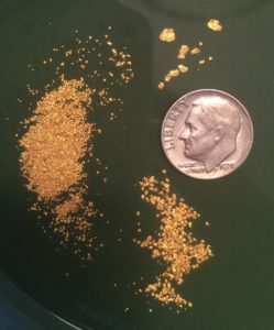
In the course of the research for my book (buy it here) and otherwise, I found quite a few online resources to be helpful. So, to give others a hand, here is my random collection of helpful web links. But first here’s a picture of some gold…because, gold.
DRCOG interactive GIS of parks in metro Denver showing ownership https://data.drcog.org/dataset/parks-recreation-and-open-space-2016
To locate and identify every little waterway in metro-Denver: http://mapsearch.udfcd.org
To check stream flows anywhere you plan to dig in the US: https://waterdata.usgs.gov/co/nwis/rt ..,and the smartphone app: RiverApp
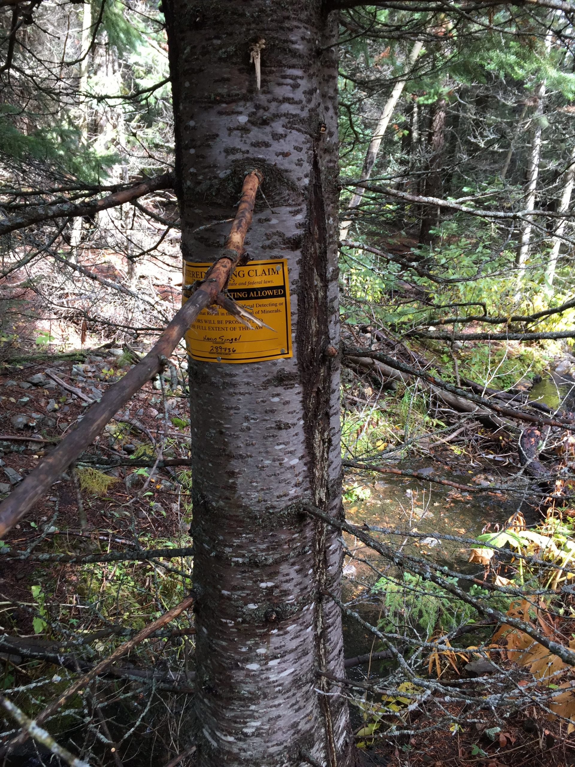
To investigate land ownership (note: federally reacquired lands will often show as private here), existence of claims (you’ll still have to check at the county too), master title plats & supplements, etc.: www.mylandmatters.org
USGS Info on mining districts. Colorado starts on page 85: https://pubs.usgs.gov/pp/0610/report.pdf
USGS database search (put ‘Colorado gold’ in the search box): https://www.sciencebase.gov/catalog/
BLM general mining information: http://www.blm.gov/programs/energy-and-minerals/mining-and-minerals
BLM staff manual on mining claims. Read what they tell their staff to do: http://www.blm.gov/style/medialib/blm/wo/Information_Resources_Management/policy/blm_handbook.Par.57322.File.dat/H%203830_1%20Administration%20of%20Mining%20Claims.pdf
BLM Field Offices in Colorado: http://www.blm.gov/colorado
Colorado, Division of Reclamation, Mining and Safety for requirements for mining within the State of Colorado. http://mining.state.co.us/
Colorado BLM mining claim guide: http://www.fs.usda.gov/Internet/FSE_DOCUMENTS/fseprd488806.pdf
Mining law: http://americanmininglawforum.myfastforum.org/
Colorado mining law summary, very helpful for claim owners:
http://www.nesbittlaw.net/articles/nesbitt-overview_colo_mng_laws.pdf
US Gov Surveys: https://glorecords.blm.gov/search/default.aspx?searchTabIndex=0&searchByTypeIndex=1#searchTabIndex=2″]General Land Office Surveys
Colorado Geological Survey http://geosurvey.state.co.us/minerals/Pages/minerals%20welcome.aspx
And especially: http://coloradogeologicalsurvey.org/mineral-resources/historic- mining-districts/ which has very useful maps with creek names and sometimes boundaries of mining districts included. Also, their store with 95% of the items being free! Here.
And generally: http://coloradogeologicalsurvey.org
Cripple Creek & Cresson Mine: http://www.newmont.com/operations-and-projects/north-america/cripple-creek-and-victor-us/overview/default.aspx The only large-scale commercial gold mine in Colorado, which is owned by a publicly traded company, so it’s also the one that is required to report its production. They do 1,000+ ounces every day of the year!
Colorado Parks & Wildlife: http://cpw.state.co.us/Documents/RulesRegs/Regulations/ChP01.pdf …see page 2 item b. 2 explicitly allowing prospecting in the Headwaters Rec Area. Speaking of which, here’s their brochure: http://cpw.state.co.us/placestogo/parks/ArkansasHeadwatersRecreationArea/Documents/ArkansasBrochure.pdf which is helpful, but you still need my book to know which access points are “good to go” for prospecting since some are private land and some are subject to claim (and are claimed.)
County Assessor Sites: Most counties in Colorado have an online map that shows land ownership. They all look about like this one: http://teller-county.maps.arcgis.com/apps/webappviewer/index.html?id=b8334345143a45968742af9ef8cf6476 You can find them by just doing an online search on “xyz county assessor” and then looking for their online map, which may be called a tax map or a GIS map or a parcel map or…you get the idea. One key note: you will see lands owned by the local county on the map, but they will generally be non-clickable since there is no ‘owner’ except the county. Since they don’t tax themselves, they don’t bother to identify those parcels of land.
Free topographic maps are available from National Geographic at https://www.natgeomaps.com/trail-maps/pdf-quads
So, what do you think of my list? What am I missing?
This site costs money to keep up. The only way it makes money is shopping referrals. If you appreciate the info here, please click thru one of my Amazon links the next time you want to shop online. It won’t cost you anything extra and it keeps the site going.
Or just toss me a gift to say thanks at: paypal.me/buyabook


2 thoughts on “Helpful websites for the small scale Colorado prospector”
Hi Kevin, recently found your website and also just purchased your book! Great stuff….I’ve definitely got the bug again! I’ve been doing some panning on some local south metro creeks and have been pleasantly surprised so far!
Question for you- do you think Kiowa Creek near Kiowa potentially may have gold? From everything I’ve found and read it seems to be east of where the gold bearing streams are, but not *that* far. I have access to a stretch of land on the stream and just wanted to get your thoughts if it may be worth exploring. Thanks again and keep up the great work!
Yes Kiowa Creek could have gold. The ancient tropical river carried gold all the way into Elbert County!