The BLM manages what it calls the Piñon Bridge Recreational Placer Mining Area to allow casual prospecting by visitors on the San Miguel River. The land highlighted in green on the map is open to casual use but is unclaimable because it was previously private (railroad company) land and was reacquired by the Federal government. This area is in far western Colorado, south of the Grand Junction area and northwest of Telluride. There is a highway along the San Miguel River that runs direct between here and Telluride.
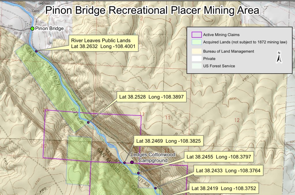
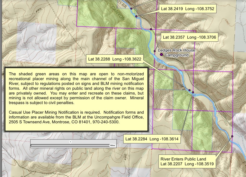
As you can see on the map, there are a couple very basic campgrounds on the southern end of the dig area. Nothing fancy, just pit toilets and picnic tables but, hey, it’s free and it’s right next to the gold in a beautiful canyon! If you want your own clean copy of the map, you can take a look in the maps included by the BLM in the Notification Form link below but note that it won’t have the GPS coordinates I have here.
Cautions:
- The San Miguel River goes from huge in the spring to almost dry in the fall…in the spring drowning is a real risk, in the fall it’s difficult to run a sluice box
- there are active, valid mining claims on the river right next to the campgrounds in the non-color-coded areas…stay out of those areas when prospecting
- be sure to get your permit from the BLM in advance and have it with you (see details below)
Prospecting tips:
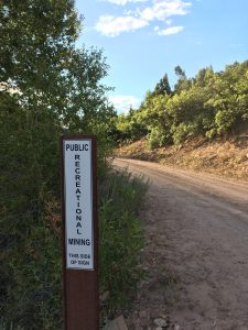
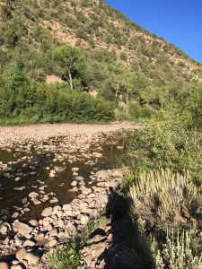
- walk the river looking for “your” spot, don’t just hang out at an access point
- there’s lots of exposed bedrock here, cleaning cracks can be fun and productive…bring crack cleaning tools, especially in August and later in the year when the water is low
To dig here, you need a free permit from the Montrose BLM office. To get the permit, either stop in the office in Montrose during regular business hours at 2505 South Townsend, Montrose …or you can print off the form from their website, sign it and send it in via email (call for current email address) for their signature. Do this WELL in advance of your visit! Here’s the form but DON’T use the email address shown, it’s out of date so call them for the current address: https://www.blm.gov/sites/blm.gov/files/uploads/CO_MINING_05042017_DOC_Rec%20Placer%20Mining%20Notification%20Form-fillable.pdf
Getting there: From the little town of Naturita, Colorado just follow Highway 141 east to the left turn onto 90. When you cross the bridge over the river, take an immediate right turn onto road BB36. BB36 barely looks like a public road at first but be bold, you are going the right way! This road is narrow and dirt with its share of potholes. We brought a high clearance vehicle and off-road ready travel trailer and loved staying in one of the campgrounds, but some large, fancy trailers might not survive the road.
This site is fun but if you want to learn about over 180 public access prospecting sites across Colorado, then you need my guidebook, Finding Gold in Colorado: Prospector’s Edition
This site costs money to keep up. The only way it makes money is shopping referrals. If you appreciate the info I’m sharing, please click thru one of my Amazon or Gold Cube links the next time you want to shop online. It won’t cost you anything extra and it keeps the site going.
Here’s another prospecting spot fairly nearby that also has free camping in the area: https://findinggoldincolorado.com/norwood-bridge-recreational-placer-mining-area-prospecting-tips/


2 thoughts on “Piñon Bridge BLM Prospecting Area – Prospecting Tips”
Kevin,
Great site, keep up the great work. Really looking forward to getting my hands on your book! The link above for the map on the wcgpaa.org website seems to be broken; I found another map of the area (though not as detailed with coordinates) at this BLM URL (maps are on pages 3 and 4): https://www.blm.gov/sites/blm.gov/files/uploads/CO_MINING_05042017_DOC_Rec%20Placer%20Mining%20Notification%20Form-fillable.pdf
Thanks Scott, I’ve deleted the comment about the origin of my map since that club pulled it down.
…and thanks for your nice words 🙂